Justification for the extension of Cuba's continental shelf in the Gulf of Mexico
Article Sidebar
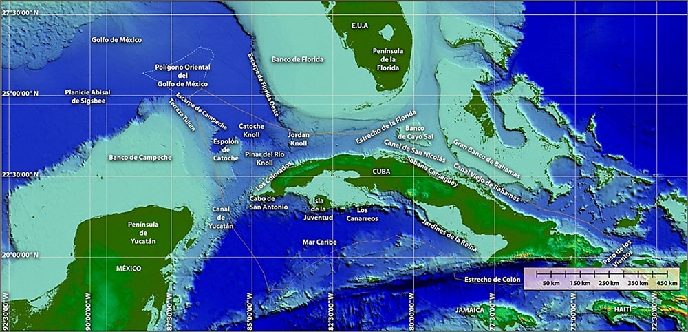
Main Article Content
Abstract
The Republic of Cuba formally submitted information to the United Nations Commission on the Limits of the Continental Shelf between 2024 and 2025, with the aim of demonstrating the natural extent of its continental shelf beyond two hundred nautical miles, measured from its baseline system in the Gulf of Mexico. This action was carried out in accordance with the 1982 United Nations Convention on the Law of the Sea. The study demonstrated this extension through the application of geophysical, geological, geomorphological, and geodetic methodologies, including the analysis of two-dimensional seismic data, RMS velocity modeling, bathymetric interpretation, and the development of algorithms to determine the toe of the continental slope, sedimentary thickness, and geodetic distances. The results demonstrated the morphological continuity between the Cuban insular shelf and the deep ocean floor, and identified valid fixed points using sedimentary thickness and distance formulas, thus establishing a continuous line along the outer edge of the continental margin. The delimitation took into account existing agreements with adjacent coastal states, in compliance with Article 83 of the Convention. The United Nations Commission approved the arguments presented by Cuba, highlighting the scientific rigor and conformity with international law of the proposed extension, which strengthens its sovereign rights over the seabed and subsoil and contributes to the advancement of geological knowledge of the Gulf of Mexico.
Article Details

This work is licensed under a Creative Commons Attribution-NonCommercial 4.0 International License.
Those authors who have publications with this journal accept the following terms of the License Attribution-NonCommercial 4.0 International (CC BY-NC 4.0):
You are free to:
- Share — copy and redistribute the material in any medium or format
- Adapt — remix, transform, and build upon the material
The licensor cannot revoke these freedoms as long as you follow the license terms.
Under the following terms:
- Attribution — You must give appropriate credit, provide a link to the license, and indicate if changes were made. You may do so in any reasonable manner, but not in any way that suggests the licensor endorses you or your use.
- NonCommercial — You may not use the material for commercial purposes.
- No additional restrictions — You may not apply legal terms or technological measures that legally restrict others from doing anything the license permits.
The journal is not responsible for the opinions and concepts expressed in the works, they are the sole responsibility of the authors. The Editor, with the assistance of the Editorial Committee, reserves the right to suggest or request advisable or necessary modifications. They are accepted to publish original scientific papers, research results of interest that have not been published or sent to another journal for the same purpose.
The mention of trademarks of equipment, instruments or specific materials is for identification purposes, and there is no promotional commitment in relation to them, neither by the authors nor by the publisher.
How to Cite
References
Buffler, R. (1977). IG2303 [Seismic survey]. University of Texas. Disponible en: https://www.marine-geo.org/tools/datasets/28393.
Buffler, R. (1983). FM1801 [Seismic survey]. University of Texas. Disponible en: https://www.marine-geo.org/tools/datasets/28168.
Christeson, G. L., et al. (2014). Deep crustal structure in the eastern Gulf of Mexico. Journal of Geophysical Research: Solid Earth, 119. https://doi.org/10.1002/2014JB011045 (doi.org in Bing).
Harris, P. T., et al. (2014). Geomorphology of the oceans. Marine Geology, 352, 4-24. Disponible en: https://www.researchgate.net/publication/260031735_Geomorphology_of_the_oceans.
Kenneth, J. (1981). Marine geology (44th ed.). Prentice Hall. ISBN 978-0135569368.
Naciones Unidas, (1982): Asamblea General, Convención de las Naciones Unidas sobre el Derecho del Mar, 10 Diciembre 1982, Disponible en: https://www.refworld.org/es/leg/trat/agonu/1982/es/40182.
Naciones Unidas. (1999). Directrices científico-técnicas de la Comisión de Límites de la Plataforma Continental (CLCS/11, CLCS/11/Corr.1, CLCS/11/Add.1). Naciones Unidas.
Naciones Unidas. (2006). Manual de capacitación sobre el trazado de los límites exteriores de la plataforma continental más allá de las 200 millas marinas y para la preparación de presentaciones de información a la Comisión de Límites de la Plataforma Continental. División de Asuntos Oceánicos y del Derecho del Mar. Naciones Unidas. ISBN 92-1-333369-2.
National Geophysical Data Center (NGDC). (2008). GEODAS data search and retrieval (Version 5.0.12) [Software]. NOAA. Disponible en: https://www.ngdc.noaa.gov/mgg/geodas.
Snedden, J. W., & Galloway, W. E. (2019). The Gulf of Mexico sedimentary basin. Cambridge University Press. ISBN 978-1-108-41902-4.